
The Canaries Companion
The only place to be when you’d like more information about the content of Canaries, first published by Jon McNeal in 2025. This supplement provides additional context and background on the photography, typography, design, and themes of the book and is intended to add more layers to its experience. Some images in the book are cropped to suit the paper format, and are presented in their uncropped form here.
This webpage is not an artist statement. It is recommended that you spend time with the book prior to spending time with this page.

Title, cover design, and typography
The title ‘Canaries’ came about from riffing with Paul Schiek, well into the image sequencing process. I came with a stack of title options that I didn’t like, and he agreed that none of them fit. After tossing out a few more options, Paul said ‘canary in a coal mine’ and it hit me immediately: ‘canaries’ was the perfect term to describe using nature against itself to protect us. It also presented an almost too-perfect metaphor for our present: who is the canary now? An urgent question, it turns out.
The color of the cover was obvious after the title was established. To play against the title (and dispel any suggestion that this book is about pretty birds) the overall design should feel elemental, with no distractions and minimal ornament. This meant no paper dust jacket and as little on the cover as possible, not even my name. Embossing the title felt like an appropriate response, given its elemental nature: pressure, depth, and dimensionality. Using gold foil was similarly elemental, symbolic of the financial considerations that drive so much of the book’s subject matter.
I came across two hand-painted signs early in the book’s production that struck an immediate chord, images of which are included below. Both used block lettering to advertise their contents. They share some lineage with the typography of the 1920-1950s, when WPA and other government-sponsored posters were prevalent and called people to action. It’s no coincidence that this era saw an explosion of super-heroes, with Superman debuting as a character in 1938. Heroic, bold, typefaces with dimensional effects were key to creating a sense of myth, confidence, capability, duty, and unquestionable righteousness. It’s also no coincidence that this era set in motion many of the systems, assumptions and challenges that are the book’s themes.
The simulated depth of the Mount Whitney Ice & Locker Plant letters was noteworthy, and I adapted its letters to the book’s title in an early draft shown below. I liked the direction but was not satisfied with reproduction options (particularly for the cover embossment) so began to explore alternates that also evoked the era. I found that the typeface ‘Industry Inc’ best conveyed the message, and selected its 3D variant for the cover.

Alpaugh Grocery, Alpaugh, California

Mount Whitney Ice & Locker Plant, Lone Pine, California. Photo by Curtis Gregory Perry
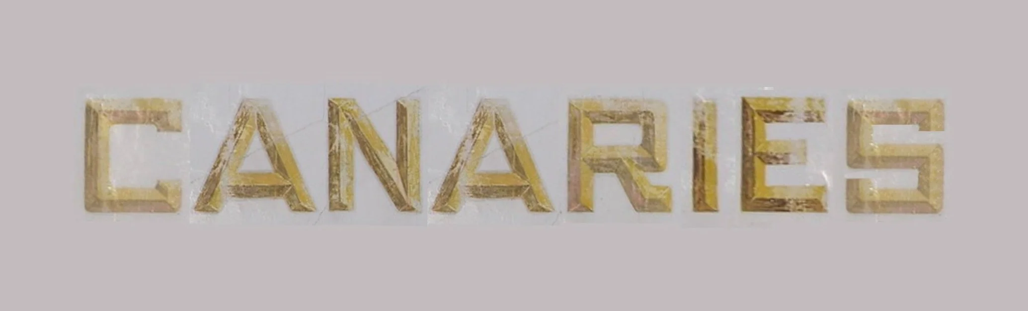
Draft composite adapting letters from found Mount Whitney Ice & Locker Plant sign to potential Canaries cover art
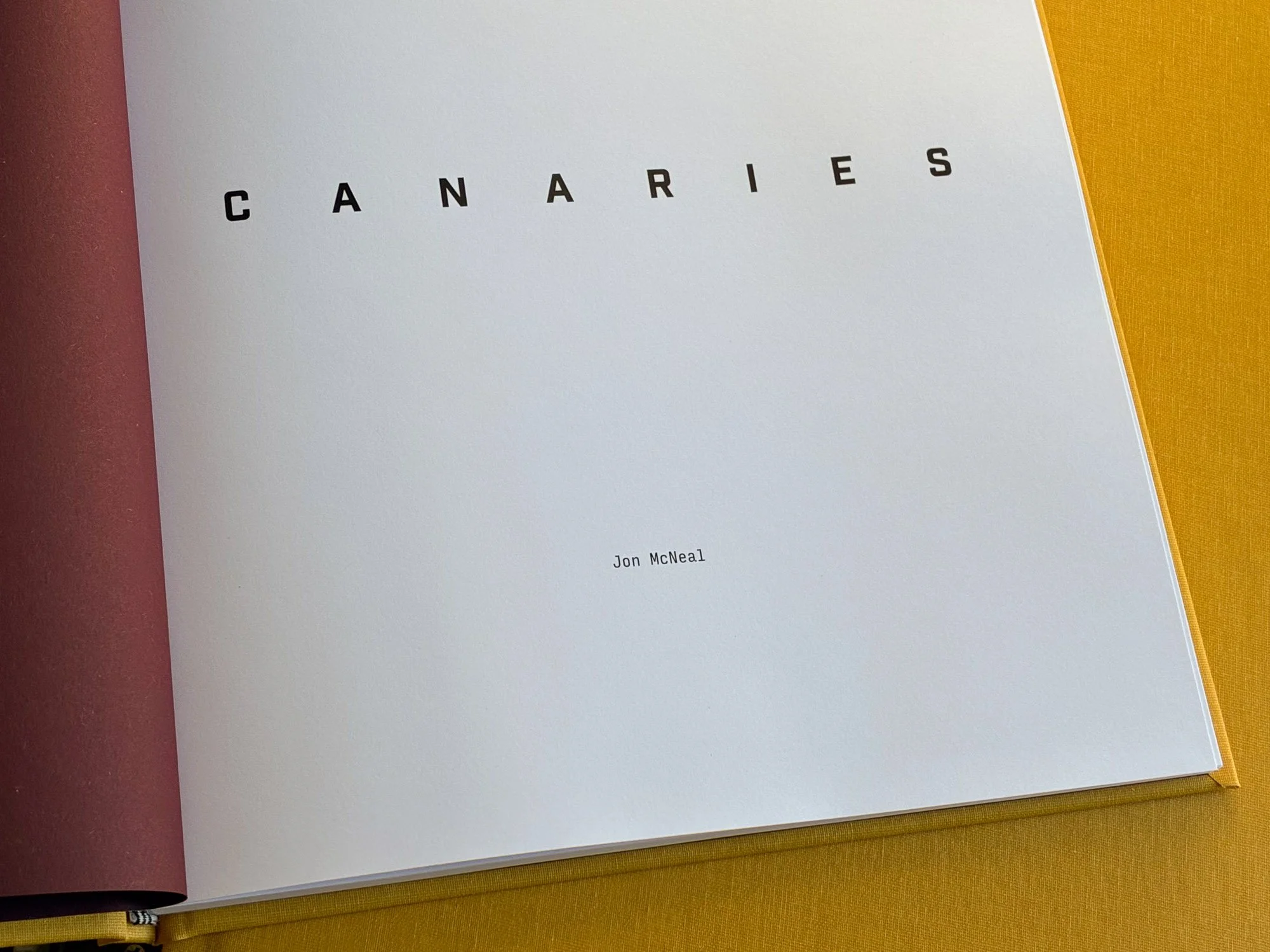

Half Title and Full Title pages
The word ‘Canaries’ appears in multiple versions of the ‘Industry Inc’ typeface on these pages, and progresses from the bold, heroic 3D version of the cover to a more traditional, smaller, less confident version on the half title page. It progresses again to a 3D version with an inverse drop shadow on the full title page, with larger but less legible letters that appear to dissolve off the paper. The intent is that the text treatment sets the story in motion.
Other than the spine, this is also the first appearance of the ‘Input Mono Condensed’ typeface family. ‘Regular’ and ‘Extra Light’ variants of it are used in the body text of the book. A monospace font (where all characters are the same width) was deliberately selected because it summons two associations:
Reporting, since typewriters typically use monospace fonts (Courier is common)
Financial documents, which use monospace fonts to align numbers when stacked in columns
Finances being what often drive decisions of land use, this latter association was especially important.

Dr. Herbert Stein quotation
This quote stopped me in my tracks when I first saw it in 2022. Its obviousness is hilarious, but betrays a touch of frustration. Its simplicity makes it applicable to anything - Dr. Stein apparently said it in response to unfavorable economic trends that he was being badgered to do something about, and this was his way of saying that it would take care of itself. Upon first reading it I first thought of it in the context of humanity’s growth, impact and reliance upon the natural environment. Expansion and degradation will indeed stop, one way or another. Whether or not we like how that happens is our decision, at least in part.
Dr. Stein served on the Nixon Administration’s Council of Economic Advisors.

Tunnel View 4
The lead-off image of the book is taken from Yosemite National Park's iconic Tunnel View. This long exposure highlights the human activity in the park, with traces of cars, climbers, and campers drawing focus from El Capitan, Half Dome and Cathedral Rocks.
This park was instrumental in the founding of the National Park Service and over 120 years of land conservation policy. It plays a significant role in the development of photography too; early adopters like Carleton Watkins and Eadweard Muybridge made iconic work here, pushing technical limits of the medium to share the landscape’s beauty and build an audience. Ansel Adams continued that tradition and it lives on today in the work of Catherine Opie, Trevor Paglen, Binh Danh, Mark Klett & Byron Wolfe, and so many others. Today, this viewpoint is photographed well over a million times per year but primarily in daylight.
In 1925/26 the infamous head of the Los Angeles Department of Water and Power William Mulholland declared to the future director of the National Park Service Horace Albright that he wanted to "go [to Yosemite] and build a dam from one side of that valley to the other and stop the goddamned waste." Albright noted that it was the "laughingly arrogant tone" of his voice that surprised him. "He almost wanted to destroy." An even greater irony is Mulholland wanted to use photography as a pretext to flood the valley. He proposed that a dozen photographers document Yosemite Valley for a year, then publish the works for all to see. For him the quality and wide distribution of the images was more valuable than preserving the physical place, and that photographs can (and in this case, should) replace reality. The parallels with current headlines about conservation, stewardship, artificial intelligence, virtual reality, social media, and even funding basic park operations - are unnerving.
Nikon D810 + 24.0-70.0 mm f/2.8 // 480 second exposure // May 2016 // Map location
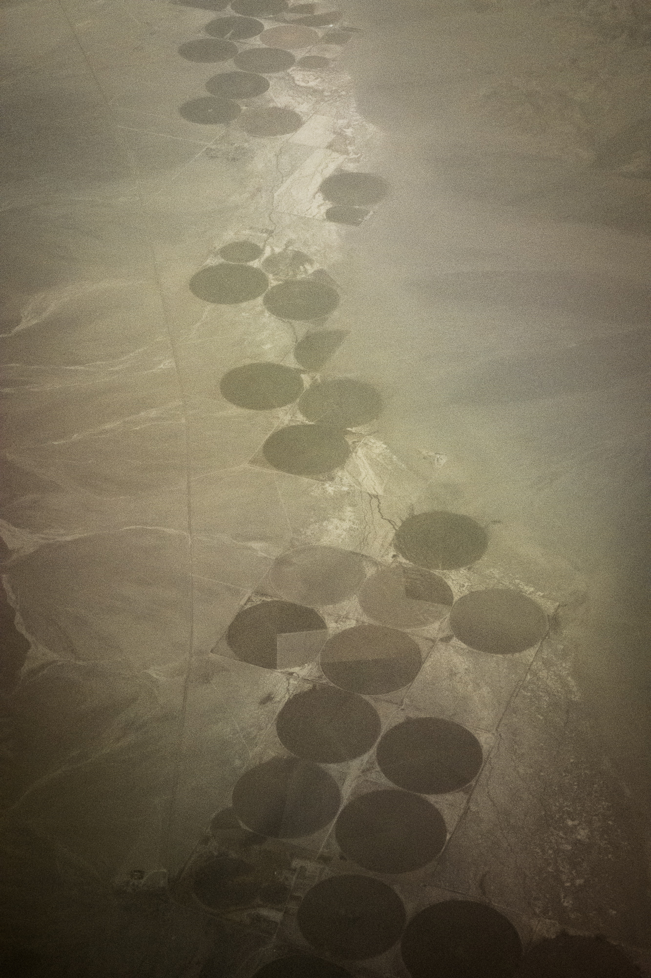
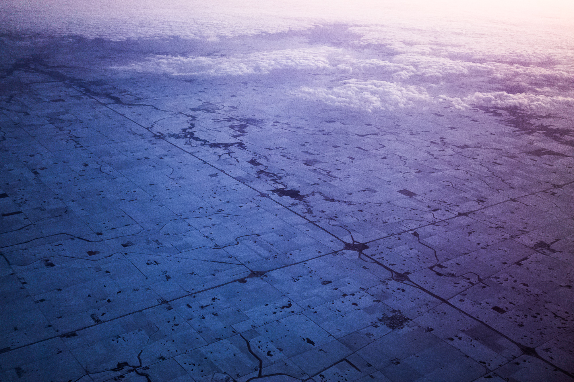
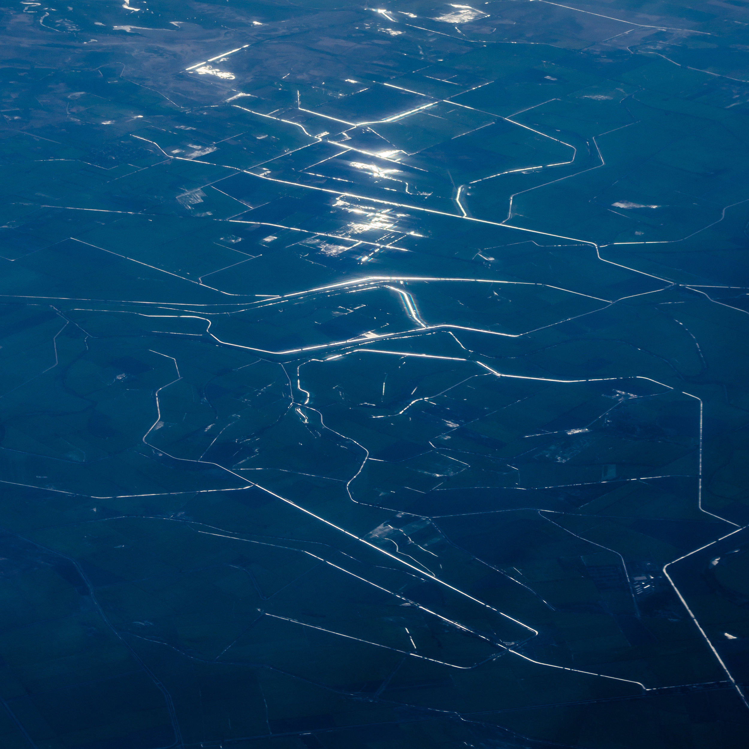
Oasis 1
Captured over Fish Lake Valley, specifically above the ironically-named town of ‘Oasis’ along the California-Nevada border. This was the launching point of Gregory Barber’s essay, and a focus of our initial conversations.
The circles in the landscape following the dry wash of the river are the crops being watered by pivot irrigation systems. These collect water from a central point (often by mining and pumping groundwater) which is then mixed with fertilizer and sprayed into the air by a rotating boom. The relatively modest amount of equipment makes it an attractive option for first costs but the amount of water lost to evaporation is significant, particularly in arid landscapes like this one. Balancing water removal from aquifers with aquifer recharge is necessary for long-term viability.
This image, like most of the aerials in this book, is captured from a commercial flight. Because of the variables of ground speed, altitude, weather, reflections and window characteristics (integrity, thickness, consistency and cleanliness) I will make hundreds or even thousands of images during a single flight. The hit rate is low (maybe 2% of the images are worth consideration after an initial assessment), but the challenge keeps me engaged and the flight tends to pass quickly. I’ll plan my seat location based on the flight’s route and anticipated sun position to improve the odds. The most important factor is to be ahead of the wing to allow for the least obstructed view with no jet wash to distort the image.
For processing I always limit myself to what I know how to do in a darkroom. I typically make relatively few edits to my ground-based images. Aerials require a very different approach, and I will perform significant adjustments to contrast and clarity to reduce the opacity of the atmosphere and reveal the feature that caught my attention when first capturing the image. Increasing contrast can often create bolder, unnaturally saturated color tones which I offset by lowering the vibrancy.
Sony DSC-RX100M2 28-100mm F1.8-4.9 // 1/640 second exposure // November 2017 // Map location

Golden Gate Bridge 22
Water in California flows uphill to money. It is a story of unequal distribution.
The bridge spans the only gap in the coastal mountains for nearly 1000 miles, and is the sole outlet for 12 major river systems that drain nearly 40% of the state.
Fujifilm GFX100S + GF250mm f/4 // 0.8 second exposure // July 2023

San Francisco 55
Six months into pandemic. Smoke from devastating wildfires in Oregon appears over California, creating an alarm-colored twilight at noon. Taping over cracks in 110+ year-old windows to keep the poison out. Trying to carry on business as usual. Eventually go outside to make more pictures. Find ground-level air quality to be surprisingly safe. By the end of the day the sky returns to its normal color but air quality deteriorates rapidly and stays hazardous for weeks.
Colloquially known as ‘the orange day.’ No one alive has seen anything like it before. No one who experienced it seems able to forget it. Those who don’t experience it firsthand don’t believe it. There will be more days like this years later, mostly on the eastern seaboard from massive Canadian wildfires.
Nikon D850 + 24.0-70.0 mm f/2.8 // 30 second exposure // September 2020
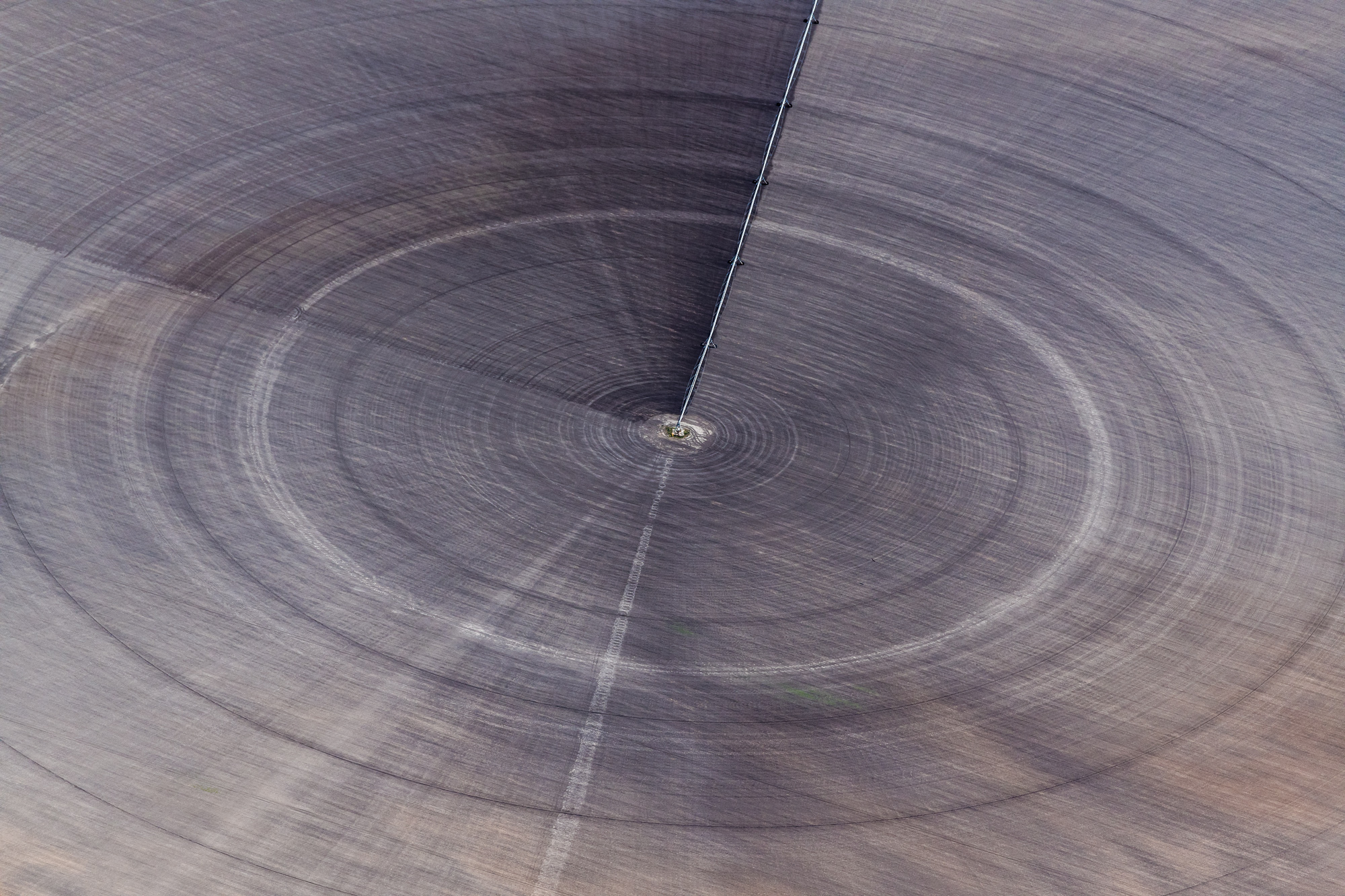
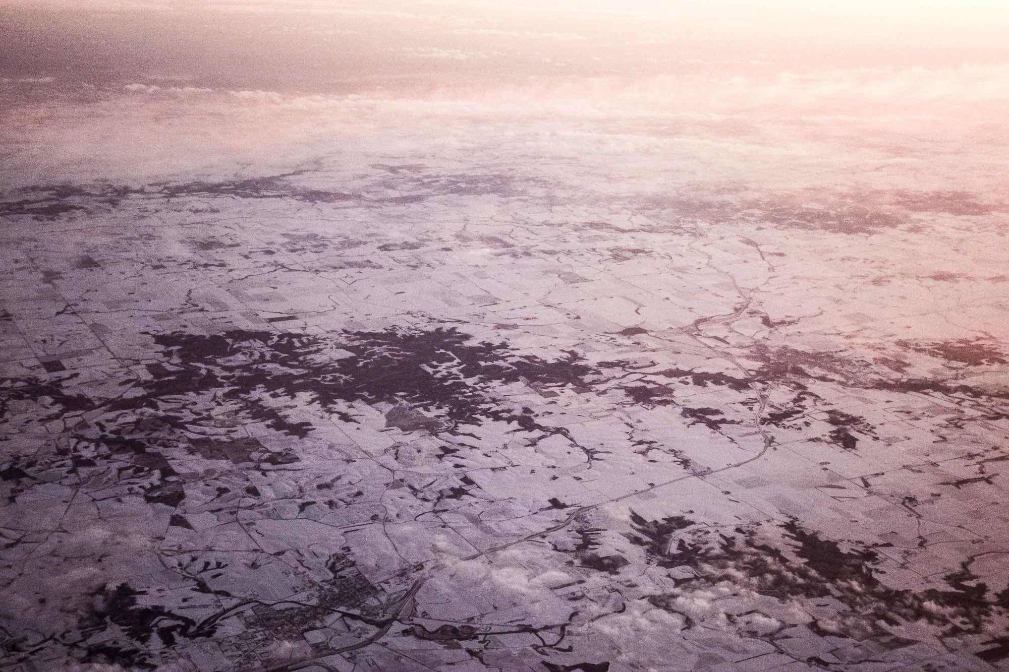
Pearsall 2
This is the only image in the book made from a private plane, a high-winged single-engine Cessna 172 over south Texas. A relative close-up of the pivot irrigation systems first encountered in the image ‘Oasis 1’ a few pages prior.
Nikon D850 + 70.0-200.0 mm f/2.8 // 1/2500 second exposure // April 2018

Yosemite Falls 6
Linking back to the opening image of Yosemite Valley. The iconic Yosemite Falls is at its spring peak of 2400 gallons per second. The falls are typically dry by August. This location and its water are highly protected and sacred here, but that changes downstream as the rules change.
Nature pushing back. Reversing the flow. Visible evaporation. Water still but ground in motion, or even water moving in reverse. Recharging the river and aquifer.
The motion of the image was captured in-camera. Post-processing was limited to minor color and contrast refinements.
Fujifilm GFX100S + GF250mm f/4 + 1.4x teleconverter // 8 second exposure // April 2024 // Map location
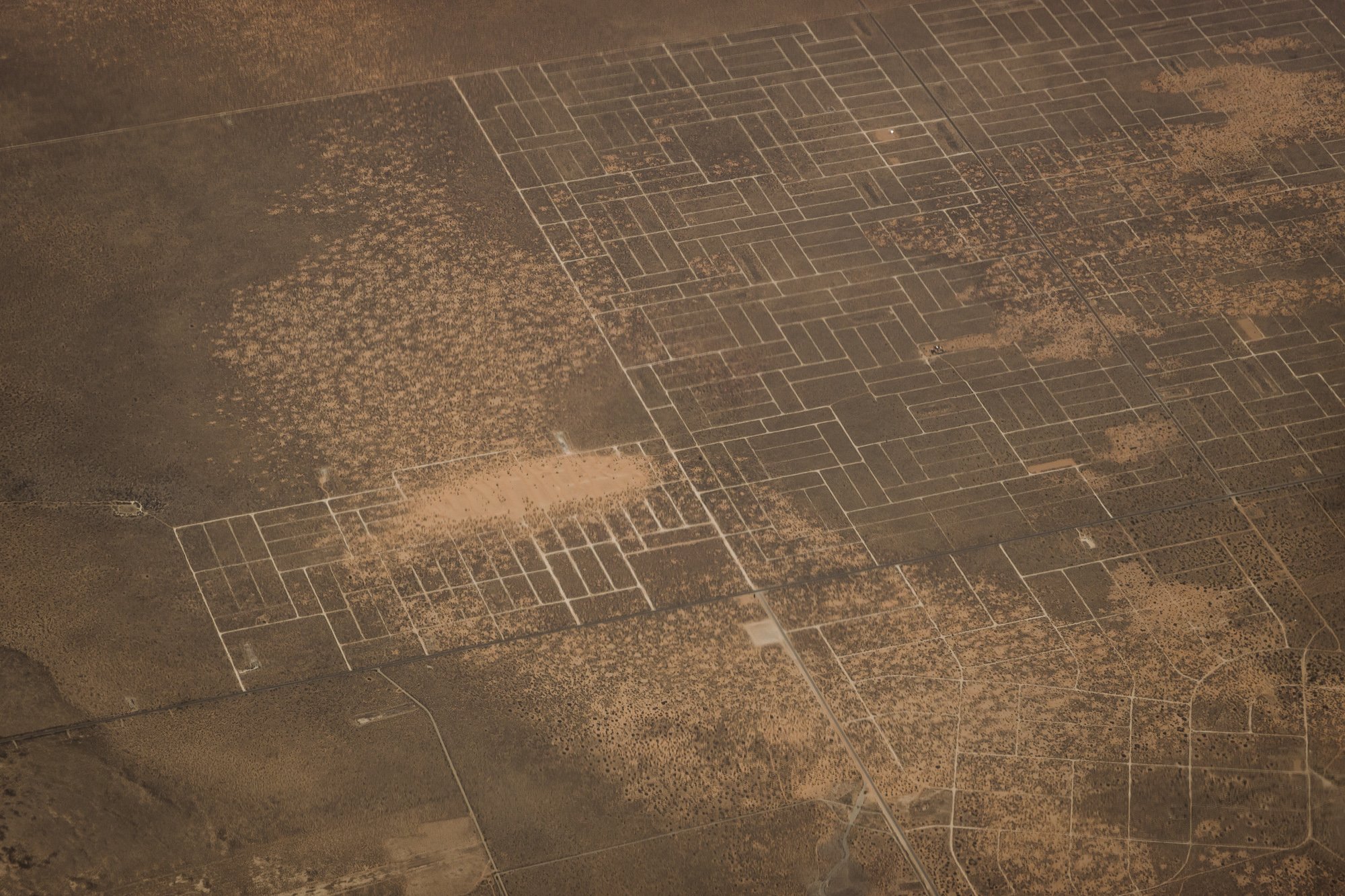
Popejoy 1
Land use policy, infrastructure and natural features collide as regular and irregular grids in north-central Iowa. This is land as business, modified and structured for productivity.
Sony DSC-RX100M2 28-100mm F1.8-4.9 // 1/400 second exposure // March 2018 // Map location

_DSC4431
The counterpoint to the previous image, with land and and its uncontrollable geologic forces set aside for spiritual reverie and tourism.
Other than the fleeting screens of other tourists’ cameras, the light of this nighttime image comes from inside the earth. A hole in the planet’s crust at the base of the Kilauea crater in Hawai’i Volcanoes National Park offers a rare glimpse into the earth’s circulatory system, and is wholly indifferent to our influence. We are observers to the simultaneous creation and destruction of land.
Like most of my images of tourist activity this image uses the file name assigned by the camera as its title. Tourists typically don’t rename their files or title their images, so I am joining that tradition.
Nikon D850 + 24.0-70.0 mm f/2.8 // 142 second exposure // April 2018 // Map location

San Francisco 31
Land as a different kind of business. The western half of San Francisco’s housing stock was largely built over a short period of time, at a relatively low density, and with a general disregard for topography.
Nikon D850 + 24.0-70.0 mm f/2.8 // 30 second exposure // November 2017
Dyersville 1
The relative rigidity of the grid starts to break down. Nature creeping in to disrupt what we would do if left to our own devices.
Sony DSC-RX100M2 28-100mm F1.8-4.9 // 1/1000 second exposure // March 2018 // Map location
Horizon City 1
Or not. A planned series of developments outside El Paso. Three years after this picture’s creation little if any of this development has changed. Coincidentally, the grid of roads is very similar to the architectural cross-hatch graphic pattern for soil.
Sony DSC-RX100M6 24-200mm F1.8-4.9 // 1/800 second exposure // May 2022 // Map location

Golden Gate Bridge 11
The book explores how we adapt the environment to our needs and what we choose to preserve, and in some cases even elevate to iconic status. But icons can be complicated. This bridge is a symbol of ingenuity, beauty and romance for many but unbearable heartbreak for others.
I resisted photographing the Golden Gate Bridge for years. It was too easy to make pictures that were pretty, familiar, and ultimately absolutely unnecessary. Years went by, and in time a few images emerged that showed just parts of the bridge. I realized that the bridge is so iconic that at some threshold people’s memories, impressions and intuitions could complete a very partial image of it. I started looking for that threshold.
Photography is inherently about memory, and fragments of icons are a heightened subset of how vision, memory, and iconography interact within our culture. There’s a moment when we all see the same thing, but it often quickly diverges from there. How much of an icon needs to remain for it to remain an icon? Where does an icon begin and end? The same questions apply to any protected space and land. How much periphery is necessary to save the center?
Nikon D850 + 70.0-200.0 mm f/2.8 // 3 second exposure // August 2019

Twin Bridges 1
An image made on the site of the August 2021 Caldor Fire. It took 69 days and over 5000 people to contain the fire that burned nearly 222,000 acres, an area larger than all of the boroughs of New York City combined. It and the near-simultaneous Dixie Fire were the first fires known to cross the Sierra Nevada mountain range. The US Forest Service determined that it was caused by a firearm, specifically two people using firearms. The court threw out the charges.
The motion of the image was captured in-camera. Post-processing was limited to minor color and contrast refinements.
Nikon D850 + 70.0-200.0 mm f/2.8 // 0.8 second exposure // September 2022 // Map location
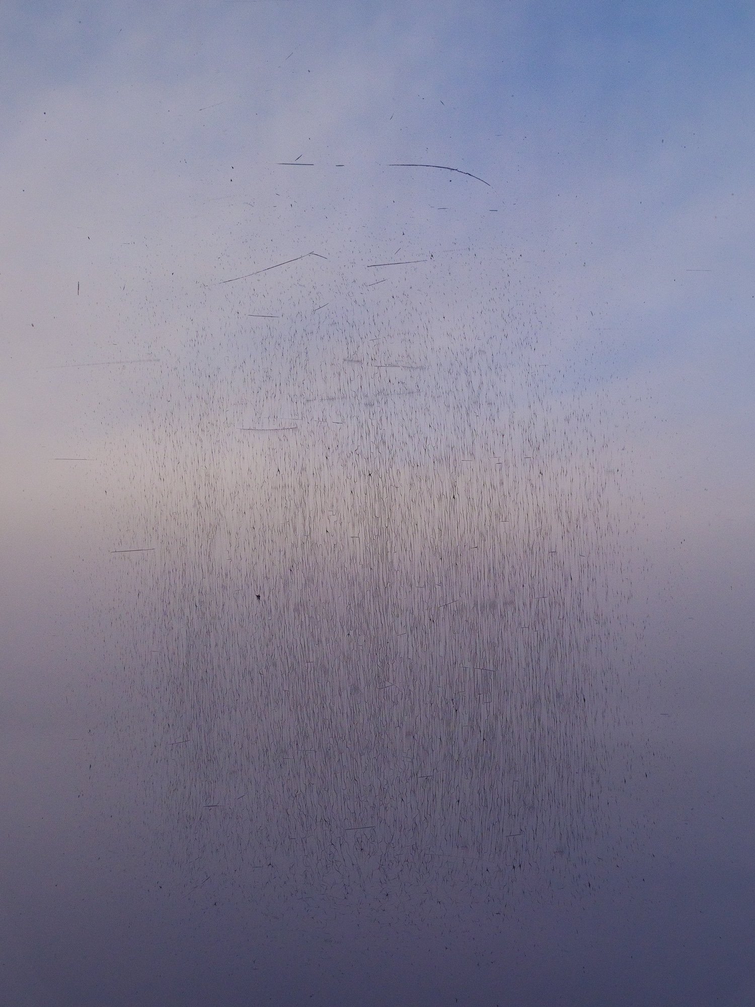
Turlock Lake 1
The scratches, or many of them, are stress fractures in the petroleum-based polycarbonate window of a commercial aircraft.
The view beyond is of the Sacramento Valley, its atmosphere clouded with particulate matter predominantly from industry and agriculture trapped by the winter inversion layer.
Fujifilm GFX100S + GF32-64mm f/4 // 1/320 second exposure // December 2022 // Map location

Twin Bridges 2
From the many trees of Twin Bridges 1 to one tree, a casualty of the same Caldor Fire.
These context images were made nearby. Poking at the web of connections between wildland interfaces, enabling infrastructure, and a more energized atmosphere. What are acceptable levels of risk? What are we conditioned to accept?
Fujifilm GFX100S + GF250mm f/4 // 13 second exposure // August 2023 // Map location


Mina 1
Sunset atmosphere photographed from over 37,000 feet.
Sony DSC-RX100M2 28-100mm F1.8-4.9 // 1/8 second exposure // July 2017 // Map location
Obrera 1
Layering on more fixes so everything works until it doesn’t.
Fujifilm GFX100S + GF45-100mm f/4 // 1/40 second exposure // November 2024

Baja California 3
Desert development along the eastern coast of Baja California.
Sony DSC-RX100M2 28-100mm F1.8-4.9 // 1/1250 second exposure // June 2017 // Map location

Saguaro 1
The single tree of Twin Bridges 2 takes on a new form.
Nikon D850 + 70.0-200.0 mm f/2.8 // 1/100 second exposure // April 2022 // Map location

Ducor 1
Trees put to work, with acres of petroleum-based netting to protect fruit and nuts from pests.
Fujifilm GFX100S + GF45-100mm f/4 // 1/13 second exposure // February 2025 // Map location


Pecos 1
Order vs. entropy. The top crust of soil, particularly in the deserts of Western America, is key to keeping the earth beneath it in place. The soil is alive: biological soil crust is made of tiny organisms that play an important role in the soil’s ecosystem. One disturbance as small as a footprint can destroy the biological soil crust and result in erosion and blowing sand. Once the top layer is compromised, adding vegetation and water are the two main tools available to prevent that erosion - a clear challenge in a desert environment. The same extends to farmland - once soil is tilled there is no going back, and it becomes much more susceptible to erosion if not planted and watered.
Sony DSC-RX100M2 28-100mm F1.8-4.9 // 1/800 second exposure // April 2018 // Map location
Sinaloa 1
The network of irrigation canals for the coastal farms of Sinaloa. Irrigation must be balanced with sufficient drainage and flushing water to avoid concentrating salts and forever poisoning the soil chemistry. This chemical change is a common reason for the failure of civilizations that relied on irrigation. Upcoming images of Death Valley and the Owens Valley illustrate this phenomenon.
Sony DSC-RX100M2 28-100mm F1.8-4.9 // 1/800 second exposure // January 2017 // Map location

Corpus Christi 3
Photosynthesis at night, nature adapting itself and leaning into what’s available.
Fujifilm GFX100S + GF32-64mm f/4 // 1/6 second exposure // December 2022 // Map location

Devil’s Golf Course 1
Badwater Basin in Death Valley, like most basins in the western United States, is a prime (and extreme) example of salt build-up from insufficient flushing and drainage.
Nikon D300 + 18.0-200.0 mm f/3.5-5.6 // 1/100 second exposure // March 2009 // Map location

Redacted 1
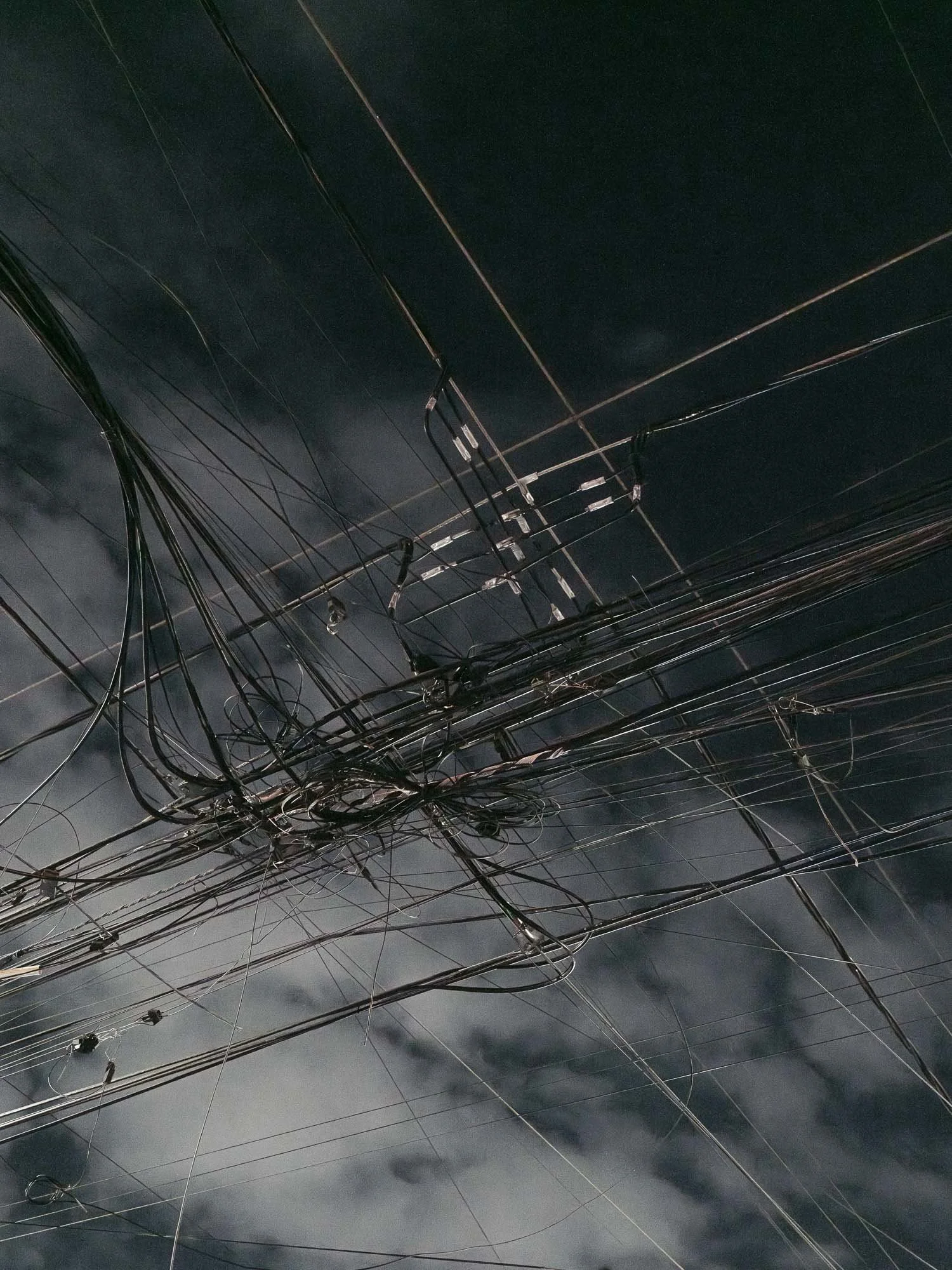
The privately-managed military munitions depot near Hawthorne, Nevada. I first encountered this site on Google Maps while trying to geolocate images of something else that I had seen during a commercial flight.
Theoretically every single piece of conventional explosive ordinance used in the Pacific theater of World War II passed through this facility. The bunkers are precisely spaced to minimize the risk of a catastrophic accidental chain reaction. This site’s unimaginable destructive capacity is made all the more surreal by the subtle patterns of earthwork which could pass for a Maya Lin or Michael Heizer land art installation. The patterns are repetitive, but thanks to the sloping topography never repeat.
The sense of scale is distorted by the valley’s massive dimensions; the mountains in Redacted 1 are over five miles away from the camera. I first visited in fall and found the distances so vast and the heat so intense that the images were not legible, so returned in the depth of winter with a much longer lens and a yellow Support our Troops magnet on the tailgate. The lens attracted the attention of the security services, who appeared out of nowhere seconds after I set up the camera. They asked me to move along, and I did.
Nikon D850 + 400.0 mm f/2.8 // 1/125 second exposure // January 2019 // Map location


_DSC3718
We don’t like it when nature gets unpredictable and weird. But that’s exactly what it does when conditions favor it, or even require it.
Nikon D850 + 24.0-70.0 mm f/2.8 // 1/125 second exposure // April 2018 // Map location

Templeton 1
Indeed.
Fujifilm GFX100S + GF45-100mm f/4 // 1/13 second exposure // February 2024 // Map location

San Francisco 48
10-second exposure at noon under natural light. No special filters. Same day as San Francisco 55.
Nikon D850 + 70.0-200.0 mm f/2.8 // 10 second exposure // September 2020

Owens Lake 1
Alkali dust storm, 3PM. The full story of Owens Lake is too expansive to include here, but it is a failure driven by greed, terraforming, displacement, and water rights.
After Los Angeles purchased most of the water rights to the Owens Valley, water that used to flow into Owens Lake was diverted over 200 miles to Los Angeles via an aqueduct. This caused the water levels of the lake to drop starting in 1913, and it would drop continuously for decades. Winds picked up fine particles of alkali dust from the newly-exposed lakebed and sandblasted communities up to 75 miles away, exposing over 40,000 people to toxic dust. 10,000 Foot tall clouds were not uncommon, and in time the dry lakebed became the single largest source of PM-10 pollution in the United States. In 1986 the US Navy identified Owens Lake dust storms as interfering with operations at China Lake Naval Air Base, a key testing ground for top-secret naval aircraft and critical to national security. This led to federal lawsuits forcing the Los Angeles Department of Water and Power to at least partially remediate the lakebed to control the dust. To date LA DWP have spent over one billion dollars on that effort, and in February 2012 declared their Owens Lake mitigation complete.
That was three years prior to the creation of this photograph.
Nikon D810 + 24.0-70.0 mm f/2.8 // 1/125 second exposure // November 2015 // Map location

Alkali dust storm from Owens Lake, also November 2015. The town of Keeler is concealed within the storm.
Dust blowing in February 2025.

Corona 1
Sunset atmosphere photographed from over 37,000 feet, 9 minutes after Mina 1. Night comes quickly.
Sony DSC-RX100M2 28-100mm F1.8-4.9 // 1/3 second exposure // July 2017 // Map location

_DSF0138
Taken inside the lodge at the North Rim of the Grand Canyon. On July 4, 2025 (three days after Canaries went to press), a lightning strike ignited a wildfire on the north rim of the Grand Canyon. Ten days later that fire destroyed this historic structure and several others.
Fujifilm GFX50S + GF32-64mm f/4 // 1/3 second exposure // October 2019 // Map location

El Capitan 4
Nikon D810 + 24.0-70.0 mm f/2.8 // 1/125 second exposure // December 2016 // Map location

Mount St. Helens 6
Mount St Helens erupted in May 1980, altering the terrain of Washington State and raining ash as far as the east coast of the US. Scores of people were killed, along with millions of plants and animals. The diversity of the devastated forest was largely replaced with a monoculture to maximize the future timber harvest. That harvest echoes the blast 45 years ago.
Nikon D850 + 24.0-70.0 mm f/2.8 // 1/80 second exposure // June 2021 // Map location

DSC_4512 (Humans from Earth)
This is the picture that unlocked the book topic for me. It was my first trip to Death Valley and quite early in my experience with taking photography seriously. I planned and approached this trip like the budding nature photographer I thought I wanted to be. Upon arrival I was initially frustrated that I couldn't get a shot without people 'in the way', until I realized that the people were the subject. What we are doing and why are just as important, sometimes more important, than where. I've found that the actions and presence of people are often evident in the pictures I make, even if the people themselves are not. Our actions echo and resonate in ways we don't always understand which compels me to keep looking.
Nikon D300 + 12.0-24.0 mm f/4.0 // 1/80 second exposure // March 2009 // Map location

San Francisco 21
Graffiti as nature, nature as graffiti. Claiming, effacing, reclaiming.
Nikon D810 + 24.0-70.0 mm f/2.8 // 1/200 second exposure // May 2015 // Map location
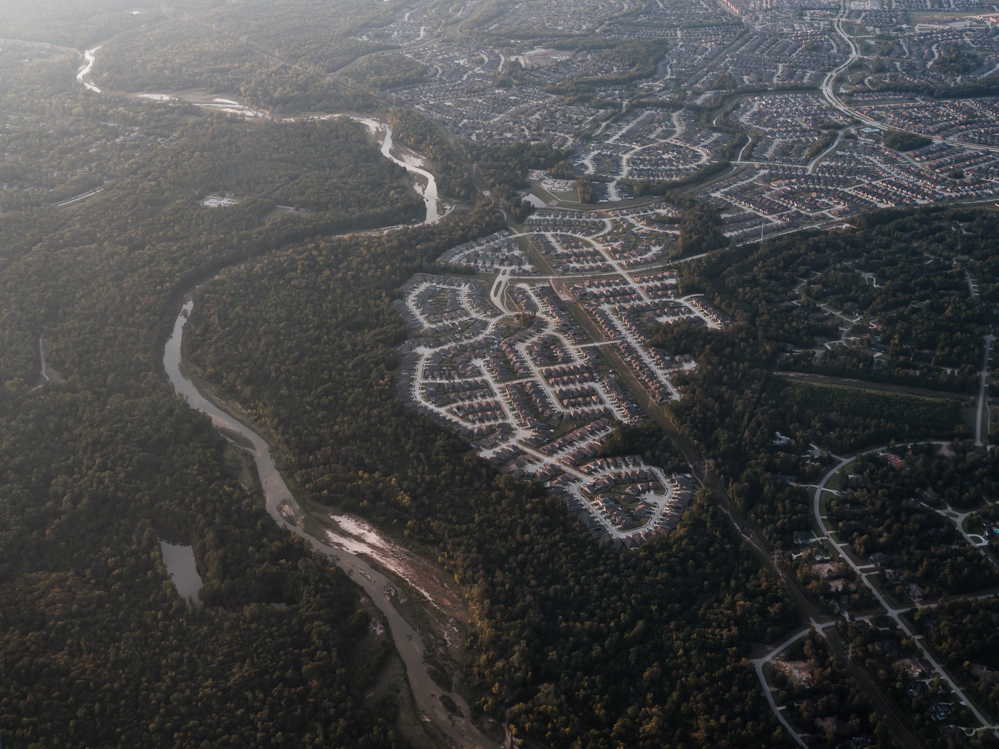
Houston 1
Newly-built single-family homes and their supporting infrastructure.
Fujifilm GFX100S + GF32-64mm f/4 // 1/320 second exposure // October 2022 // Map location

San Francisco 53
The decommissioned Hunter’s Point Naval Shipyard in San Francisco. Components of the first atomic weapon used in war (Little Boy, dropped on Hiroshima, Japan) passed through here on its fateful trip. The effects linger today. Ships exposed to atomic testing in the Pacific were brought to the shipyard to be cleaned, and the radioactive residue has marred the area for decades. It is now a superfund site that has been partially re-developed with housing, a much needed commodity in the Bay Area. Housing construction was halted after evidence surfaced that clean-up testing was being falsified. Two ‘rogue’ personnel from the contracted remediation company pleaded guilty and were sentenced to prison in 2018. Re-testing and clean-up of the site continues, as do lawsuits brought by many parties involved in the redevelopment. Uncertainty about the future of the site and its toxic legacy abounds.
Nikon D850 + 70.0-200.0 mm f/2.8 // 1/320 second exposure // January 2023

Golden Gate Bridge 17
The motion of the image was captured in-camera. Post-processing was limited to minor color refinements.
Fujifilm GFX100S + GF32-64mm f/4 // 3 second exposure // November 2022 // Map location

Kimberly 1
Mesh covers the rock exposed from road excavation. Buying time, hoping this can hold it off for a little while longer.
Fujifilm GFX100S + GF45-100mm f/4 // 1/40 second exposure // October 2023 // Map location

Ciudad Juarez 2
Ciudad Juarez occupies the most of the image, with the Rio Grande and United States’ border wall tracing the lower left quarter. The writing on the Cerro Bola mountainside reads ‘CD. Juarez. La Biblia es la Verdad. Leela’, translating as ‘City of Juarez: The Bible is the Truth, Read It’.
Fujifilm GFX100S + GF32-64mm f/4 // 1/200 second exposure // October 2022 // Map location

Yosemite West 1
Nikon D850 + 24.0-70.0 mm f/2.8 // 1/200 second exposure // September 2018 // Map location

_DSF0686
Fujifilm GFX50S + GF32-64mm f/4 // 1/500 second exposure // October 2019 // Map location

Death Valley 8
Fujifilm GFX100S + GF45-100mm f/4 // 1/500 second exposure // February 2025 // Map location

San Francisco Bay 11
Alcatraz. Last stand.
Fujifilm GFX100S + GF45-100mm f/4 // 1/500 second exposure // September 2024 // Map location
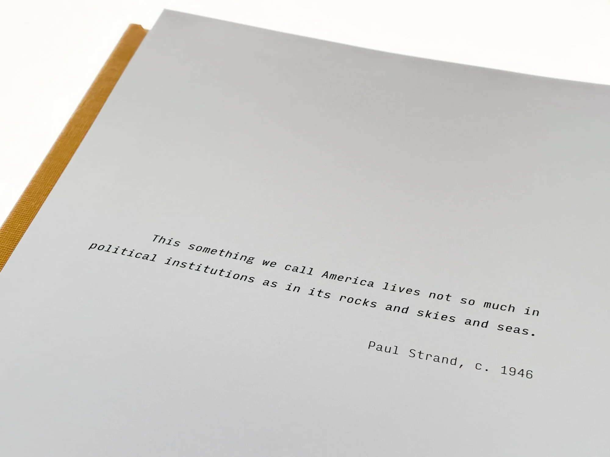
Paul Strand quotation
What is a country? What is its land?

Bonny Doon 1
Trees damaged by the 2020 CZU lightning complex fire. Trees removed by 2025.
Nikon D850 + 24.0-70.0 mm f/2.8 // 30 second exposure // December 2020 // Map location
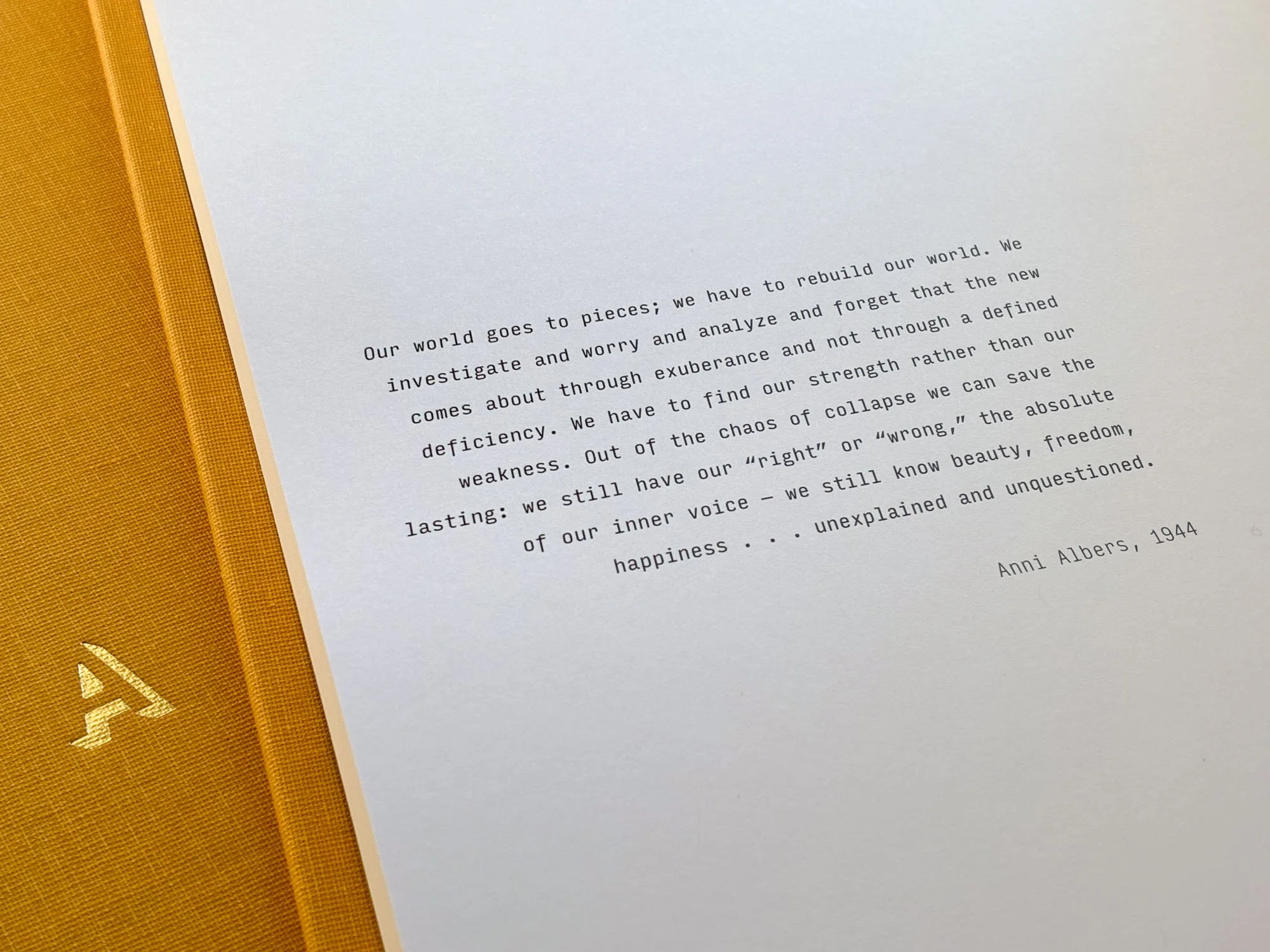
Anni Albers quotation
My friend Rachel shared this quote when the book layout was near completion. She had no idea I was working on a book, but it immediately resonated with its themes. I was heartened that someone could see so clearly amidst the propaganda and terror of World War II. Our era’s multi-front attacks on truth create a new fragility to the ‘lasting…right and wrong’, which makes the quotation more debatable but also necessarily urgent. If that collective right and wrong voice is fractured, are we in a position to rebuild our world? Do beauty, freedom and happiness take on a greater role?

_DSF4686
Coming up for air in White Sands National Park. Garry Winogrand made phenomenal images of humans using the picnic shelters here as a part of his cross-country drive in 1964. Those images have stayed with me since my first encounter, and have likely had overt and subliminal influences on my tourist images.
The park is wholly surrounded by the White Sands Missile Range, now managed by the US Army. The world’s first atomic bomb was detonated at the northern part of the range in 1945. Today, the range closes roads and access to the National Park several times per year for missile testing.
This is the only full-bleed image in the book.
Fujifilm GFX100S + GF32-64mm f/4 // 1/30 second exposure // April 2022 // Map location
A kind of bibliography:
A few books were in my head or hands while making the images for and producing Canaries. Among them, in alphabetical order:
Cadillac Desert by Marc Reisner
Carleton Watkins: Making the West American by Tyler Green
The Dreamt Land by Mark Arax
The Fight to Save the Town by Michelle Wilde Anderson
Hope Dies Last by Alan Weisman
The Hour of Land by Terry Tempest Williams
The Light Eaters by Zoë Schlanger
The Nevada Test Site by Emmet Gowin
Thoughts on Landscape by Frank Golkhe
Why People Photograph by Robert Adams
Notes on sustainability:
At a basic level, the most sustainable thing is to not make a book (or even pictures) at all, but if the book inspires a mindset that leads to healthier environmental choices then I hope the net effect is positive. The production and shipping of this book aimed to reduce its carbon footprint and environmental impact at every opportunity where a choice was available. This includes features like:
Book design, image processing, image editing, and storage performed on computers powered by solely renewable energy. Even the camera batteries were typically charged with renewable energy when available. Cameras and other equipment have been up-cycled, re-sold, or donated when replaced. Any remaining electronic waste has been properly disposed.
Book production and materials: book printed in the United States to avoid overseas shipping, using exclusively FSC-certified paper. The hardback board is also FSC-certified and 100% recycled.
Packaging: the plastic-free packaging is made of recycled and recyclable paper material. For those who ordered a book with an editioned print, the acetate-like print packaging is commercially compostable. The books were never shrink-wrapped at any point, avoiding the single-use plastics. While the amount of packaging might be beyond the average for delivered books, I wanted to avoid the least sustainable scenario which is discarding and replacing a damaged book.
Shipping: Ground shipping avoids the impacts associated with high-altitude emissions.
Audio elements in the mix during the creation of this book:
Thanks to the musical artists who were present during the many months of production of this book. In no particular order: The Weather Station, David Holmes, Yeah Yeah Yeahs, Pulp, Pyramids, Yellow Magic Orchestra, Broken Social Scene, Cut Copy, Ahmad Jamal, Handsome Furs, Ali, Eno·Hyde, Underworld, Les McCann. A playlist of all of them would be the stuff of nightmares, so I’m not attempting one. KEXP and WWOZ did a lot of the musical driving, and are worthy of your ears and support. Marc Maron and his podcast guests accompanied on the road trips where many of these images were made, and provided plenty of entertainment and inspiration. Also a shout-out to Werner Herzog for being himself.
The “Weird Al” Yankovic parody of the book would likely be called ‘Carnitas’.